Helping journalists verify online news information
In our hyper-connected world, breaking news is often first reported over social media by ordinary people who are on scene, not by professional journalists. But such news reports may not be true - there are many false stories circulating, and journalists need to be able to quickly separate truth from lies, propaganda from facts.
We have addressed these challenges in the REVEAL project, where IT Innovation have worked on Geoparsing, Geosemantics, Trust & Credibility Modelling, Decision Support System, Visualization, and Social media crawling. As part of this work, we have developed a Journalist Decision Support System (JDSS) for which we have recently launched a live online demo. We have also developed a scalable geoparsing library and a dashboard to help journalists gauge the possible bias of any resource (e.g. person or organisation) in Wikipedia.
Journalist Decision Support System - JDSS
The Journalist Decision Support System (JDSS) quickly gets journalists to the right content so they can make user generated content (UGC) verification decisions quicker.
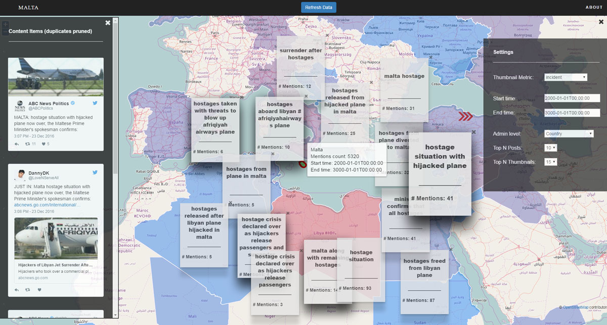
The JDSS is a free scalable Twitter analytics platform allowing journalists to crawl Twitter for posts and find UGC relevant to verification tasks. Up to 19 journalists can use JDSS simultaneously, each interactively browsing 10,000’s of posts in real-time. Background analytics are automatically run on all posts, including sentiment analysis, fake and eyewitness media labelling and newsworthy claim extraction. Journalists can interactively explore posts, clustering and sub-clustering the data to quickly find groups of contextual posts highly related to the event or claim being verified.
Scalable Python Geoparse Library - geoparsepy
Geoparsing is the process of extracting a location from text. Services such as Google Geocoding API, OpenStreetMap Nominatim and Bing Maps API allow you to post a textual phrase and get back a likely location that matches it, along with a longitude and latitude coordinate. Our geoparsepy Python library allows you to do this locally, avoid all rate limits and use associated textual clues for more accurate location disambiguation. This means you can scale up without rate limits and accurately geoparse 100,000’s of tweets whenever you want, not just 2,500 every 24 hours as is provided by the free version of the Google Geocoding API.
Bias in Linked Open Data - BLinD
Bias in Linked Open Data (BLinD) is a free dashboard to support source bias analytics. BLinD automatically compiles Wikipedia evidence about sources so journalists can focus on making decisions about potential bias. It contains interactive visualisations to provide a quick and simple way to visually examine a bias report whilst keeping all the links back to the original evidence on Wikipedia. Data sources include DBpedia and Wikidata.